Online Bike, Running and Outdoor Store
1 item
  • Relevance
  • Price Low to High
  • Price High to Low
  • Rating
  • Ratings Number

You have viewed 1 product out of 1

Hiking GPS: A Multifunctional Accessory

Devices dedicated to hiking are designed to provide precise positioning even in remote areas. They usually combine multiple satellite networks to ensure stable reception in wooded or rugged environments. The presence of an integrated map background, often topographic, allows for clear reading of terrain, paths, trails, or forested areas. Some models also allow loading additional maps via a microSD card. Battery life is a central criterion: the most enduring units often exceed 20 hours, thanks to internal batteries or AA batteries. Waterproofing and shock resistance have become common requirements, ensuring reliable use in all weather conditions, whether in the mountains or on flat terrain.

Hiking GPS: Various Formats Available

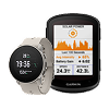
Two main formats coexist. GPS watches, lightweight and discreet, appeal due to their compactness and portability. They are often preferred for fast-paced sports activities or trail running, but their small screen and limited battery life restrict prolonged use over several days. In contrast, handheld GPS units, though bulkier, feature larger, sometimes touch-sensitive screens, making them easier to read in bright sunlight and interact with while wearing gloves. Their robustness, extended battery life, and rich navigation options make them better suited for challenging hikes or expeditions.

Common Models and Observed Performance

Some hiking GPS devices stand out for their consistent presence in specialized selections. The Garmin eTrex 32x, frequently mentioned, is based on a reliable foundation, with a readable screen, appreciable battery life, and preloaded maps suitable for Western Europe. Compact and budget-friendly, it remains a popular choice. The Montana series, such as the 700i or 680T, expand functionality with a large touchscreen, enhanced sensors, advanced connectivity, and versatile navigation, making them suitable for complex routes. Other brands like TwoNav offer robust units (Cross, Terra, etc.) that integrate IGN or OpenStreetMap maps, detailed guidance systems, and compatibility with third-party planning platforms. These models prioritize precision and fine management of tracks on varied terrain.

Criteria to Consider Based on Needs

Priorities vary depending on the intended use. For day trips on marked trails, a simple, compact, and lightweight model may suffice. However, for long treks or poorly covered areas, battery life, sensor quality (electronic compass, barometric altimeter), and ergonomics become key selection criteria. A touchscreen interface can be practical in mild conditions, while buttons remain more reliable in wet weather or winter. Some hiking GPS devices also allow sharing tracks, recording segments, or receiving smartphone-linked notifications. Weight, screen readability, power source type, and map format compatibility are all parameters to consider based on the terrain and desired level of autonomy.

Hiking GPS - FAQ

What is the difference between a hiking GPS and a mobile app on a smartphone?

A hiking GPS is a dedicated outdoor navigation device designed to work even without a mobile network. It is more robust, more accurate in remote areas, and has better battery life than a smartphone. Unlike apps, it remains reliable in extreme conditions, thanks to its shock and water resistance, and the presence of specific sensors such as a barometric altimeter or electronic compass.

Should I choose a GPS with a touchscreen or buttons?

The choice depends on the conditions of use. Touchscreens are practical and quick to operate but may lose responsiveness in the rain or when wearing gloves. Button-operated models are often preferred for winter or challenging hikes, as they provide better control in all circumstances.

What are the best brands or ranges for regular mountain use?

Brands like Garmin and TwoNav offer reliable and proven models for mountain use. The eTrex and Montana series, or the TwoNav Cross and Terra GPS units, provide advanced features, good battery life, and navigation suitable for complex environments.

Are maps included, or do I need to buy them separately?

Some GPS devices come with preloaded topographic maps, often limited to Europe or a specific country. Others require the purchase or download of additional maps via a microSD card or dedicated software. It is important to check what is included with the chosen model.

How many hours of battery life can I expect in real-world conditions?

Battery life varies depending on the device and settings used. Generally, GPS units offer between 15 and 25 hours of continuous use. Some models allow you to save battery by using an expedition mode or by limiting the frequency of data recording.

Does a GPS work without a mobile network or internet connection?

Yes, a hiking GPS works using satellite signals, independently of the mobile network. Once maps are installed on the device, navigation remains operational everywhere, even in areas without coverage or offline.

What are the advantages of a model with a barometric altimeter and electronic compass?

A barometric altimeter provides more accurate altitude readings in the mountains than a simple GPS signal. The electronic compass allows you to orient the map even when stationary, making it easier to anticipate direction changes or identify surrounding peaks and paths.

Can a hiking GPS be used for cycling or other activities?

Yes, some models are versatile and adapt to different activities such as cycling, kayaking, or ski touring. However, it is advisable to check the mounting options, compatibility with accessories, and the activity profiles offered by the device.

How do I import or export GPX tracks?

GPX files can be transferred via USB cable, memory card, or wireless connectivity (Bluetooth or Wi-Fi, depending on the model). Most hiking GPS devices are compatible with software or platforms like BaseCamp, VisuGPX, Komoot, or Strava for route planning or analysis.

Are all GPS devices waterproof and shock-resistant?

Most hiking GPS devices are IPX7 certified, meaning they can withstand temporary immersion and are protected against rain or splashes. Robustness varies from model to model, but reinforced units are generally designed to withstand shocks, temperature variations, and intensive outdoor use.


Alltricks

ALLTRICKS NEWSLETTER

Sign up to receive the Alltricks Newsletter, special offers & discounts!

Our Partners

(1) Terms and conditions apply. Valid on products sold and shipped by Alltricks. (2) GMT+1 timezone, Credit Card and PayPal orders only. Until 6pm with Chronopost and until 3pm with other delivery methods. Excluding holidays. (3) Unlimited free delivery with Alltricks+ on all products sold and shipped by Alltricks. Valid in France only with: Chronopost relais and Chronopost domicile (Chronopost on on appointment excluded), Mondial relay, Colissimo and France Express.